Search by Feature Types
- All Features
- Albedo Feature
- Arcus, arcūs
- Collis, colles
- Crater, craters
- Facula, faculae
- Fluctus, fluctūs
- Flumen, flumina
- Fretum, freta
- Insula, insulae
- Labyrinthus, labyrinthi
- Lacuna, lacunae
- Lacus, lacūs
- Large ringed feature
- Macula, maculae
- Mare, maria
- Mons, montes
- Patera, paterae
- Planitia, planitiae
- Regio, regiones
- Sinus, sinūs
- Terra, terrae
- Unda, undae
- Virga, virgae

Titan Images With Names
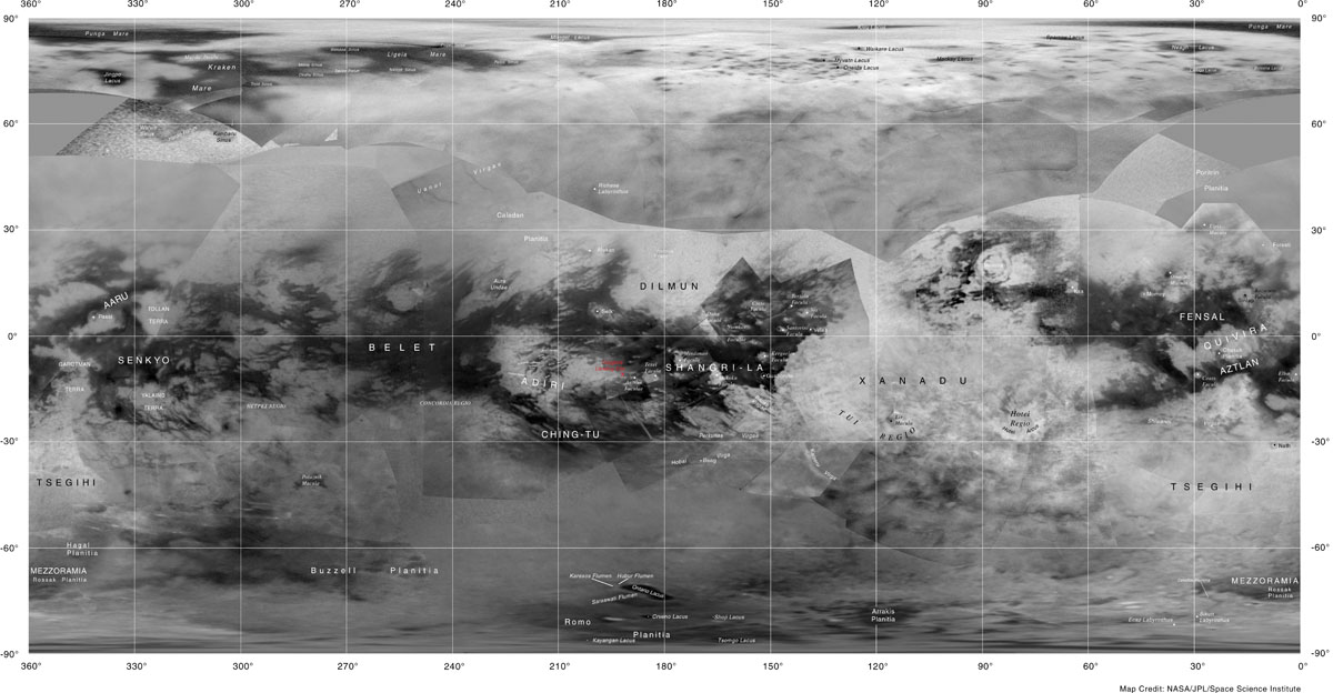
- Titan with ISS background Not all features are shown on this map, however a few features, including some faculae, planitiae and regiones, can be seen better here than on the VIMS maps. Map covers area between 90°N and 90°S.
- Titan with VIMS background and RADAR strips All named features between 50°N and 90°S are included. Map covers area between 90°N and 90°S.
- Titan VIMS image Only prominent albedo features and a few other features that are easily distinguished are included. Map covers area between 90°N and 90°S.
- Titan North Pole Includes features that are between 50°N and 90°N. The image is false color Cassini RADAR that distinguishes liquid hydrocarbon from dry land.
- Titan South Pole Includes features that are between 50°S and 90°S. The image is false color Cassini RADAR that distinguishes liquid hydrocarbon from dry land.
GIS Downloads
For All Approved Features:
TITAN_nomenclature.zip
TITAN_nomenclature.kmz


